
Transit disruptions and building evacuations reported, citizens warned against aftershocks.
By Namith DP | August 03, 2025
Introduction: Earth’s Whisper Visibly Felt
At 10:18 PM ET on August 2, 2025, a magnitude 3.0 earthquake occurred beneath Hasbrouck Heights, New Jersey, at a depth of approximately 6.2 miles (10 kilometers). The epicenter lay roughly 8 miles (13 km) west of Central Park, based on U.S. Geological Survey (USGS) data. The tremor moved through Upper Manhattan, Riverdale in the Bronx, Staten Island and parts of Brooklyn. Social media lit up as residents described sudden bangs and brief swaying—though emergency agencies confirmed no injuries or structural damage.
Event Summary: Facts, Measurements, Location
Key Earthquake Metrics

- Magnitude: 3.0 standard moment-magnitude scale (Mw)
- Epicenter: Hasbrouck Heights, New Jersey (~8 mi / 13 km west of Central Park)
- Depth: 6.2 mi (10 km) beneath surface
- Local Time: August 2, 2025, at ~10:18 PM ET
Felt Area
- Reports of shaking extended across Upper Manhattan, The Bronx (Riverdale), Brooklyn, and Staten Island.
- Exactly no injuries reported, and no structural damage confirmed by authorities including NYC Emergency Management.
Voices from the Ground
Residents described:
- In Nutley, New Jersey:“It sounded like a bang, followed by a shake and it lasted about two seconds,” said one witness.
- On Staten Island:“It almost sounded like a car hit the side of the house, the house was swaying,” recalled another resident.
- In Brooklyn:“A very brief tremor, just a slight swaying for a moment,” according to one person living in the borough.
These perceptual accounts emphasize that even moderate-level quakes in intraplate zones can elicit strong impressions in dense urban settings.
Geological & Seismic Context
Historical Seismicity near NYC
- The strongest magnitude in the region in the past ten years reached 4.8, recorded on April 5, 2024, centered near Tewksbury Township, New Jersey (~40 mi west of NYC, depth 4.7 km). That quake produced dozens of aftershocks, the largest magnitude 3.8, and caused no serious damage.
- The largest recorded historic quake in the vicinity occurred in 1884 (estimated magnitude 5.0), between Brooklyn and Sandy Hook. No fatalities were recorded.
Regional Seismic Mechanisms
- The region lies in an intraplate zone far from tectonic plate boundaries, where ancient faults (e.g. Ramapo Fault zone) occasionally reactivate under modern crustal stress.
- Fault systems such as the Ramapo Fault and the Flemington Fault extend through New York, New Jersey and Pennsylvania; most intraplate seismicity remains diffuse and difficult to attribute to a specific fault line.
Risk Assessment & Aftershocks
Risk Profile

- A magnitude 3.0 event poses very low immediate risk to human safety or infrastructure.
- Dense urban areas amplify awareness, yet recorded shaking remained mild and localized.
Aftershock Probability
- Following the 2024 M4.8 event, USGS recorded multiple aftershocks including M3.8 and lower in quick succession.
- For the August 2 event, USGS may issue a short-term aftershock forecast; based on historical patterns, minor aftershocks (typically M below 2.5) remain possible but unlikely to cause damage or be widely felt.
Preparedness: Guidance & Recommendations
- Residents Should:
- Follow “drop-cover-hold” procedures if another tremor occurs.
- Inspect heavy unsecured items (bookshelves, glass cabinets) after any shake.
- Report visible damage to official hotlines or through Notify NYC.
- Authorities Should:
- Maintain public communication via emergency channels to confirm status.
- Review and update emergency drill protocols for seismic events, rare though they are.
- Provide accessible resources on intraplate seismic risk and structural reinforcement, especially for older buildings lacking seismic building codes.
Comparative Table: Recent Earthquakes (NY Area)
| Event Date | Magnitude | Epicenter | Depth | Description |
|---|---|---|---|---|
| Aug 2, 2025 | 3.0 | Hasbrouck Heights, NJ | ~6.2 mi | Brief shake across NYC; no damage, no injuries |
| April 5, 2024 | 4.8 | Tewksbury Twp., NJ (~40 mi W) | ~4.7 km | Widely felt; dozens of minor aftershocks; no damage |
| Sept 5, 1944 (historical) | ~5.8 | Cornwall–Massena area, NY | ~20 km | Minor infrastructure damage; no casualties |
Earthquake Preparedness in New York City
Although New York City is not located along a major fault line, emergency management agencies do not ignore the threat of seismic events. In fact, city and federal authorities have protocols in place to respond to low-probability but high-impact disasters, including earthquakes.
Building Retrofitting and Seismic Standards
- Building Codes: New York City’s building code incorporates certain seismic design requirements based on guidance from the International Building Code (IBC) and National Earthquake Hazards Reduction Program (NEHRP).
- Critical Infrastructure: Essential services such as bridges, tunnels, hospitals, water treatment plants, and power substations are subject to additional scrutiny for seismic resilience.
- Retrofitting Initiatives: Older buildings constructed before the 1995 code revisions may not meet current seismic standards. Although retrofitting is not universally required, many public and institutional buildings—especially schools and emergency facilities—have undergone structural evaluations and upgrades.
Emergency Preparedness Programs
The New York City Emergency Management (NYCEM) and the Federal Emergency Management Agency (FEMA) conduct joint exercises and preparedness campaigns tailored to seismic risks:
- ShakeOut Drills: NYC participates in the annual “Great NorthEast ShakeOut,” a region-wide drill encouraging residents to practice “Drop, Cover, and Hold On” techniques. In 2024, over 400,000 New Yorkers registered for the drill.
- Community Outreach: NYCEM operates the Ready New York program, which distributes earthquake preparedness guides to schools, public housing complexes, and community centers.
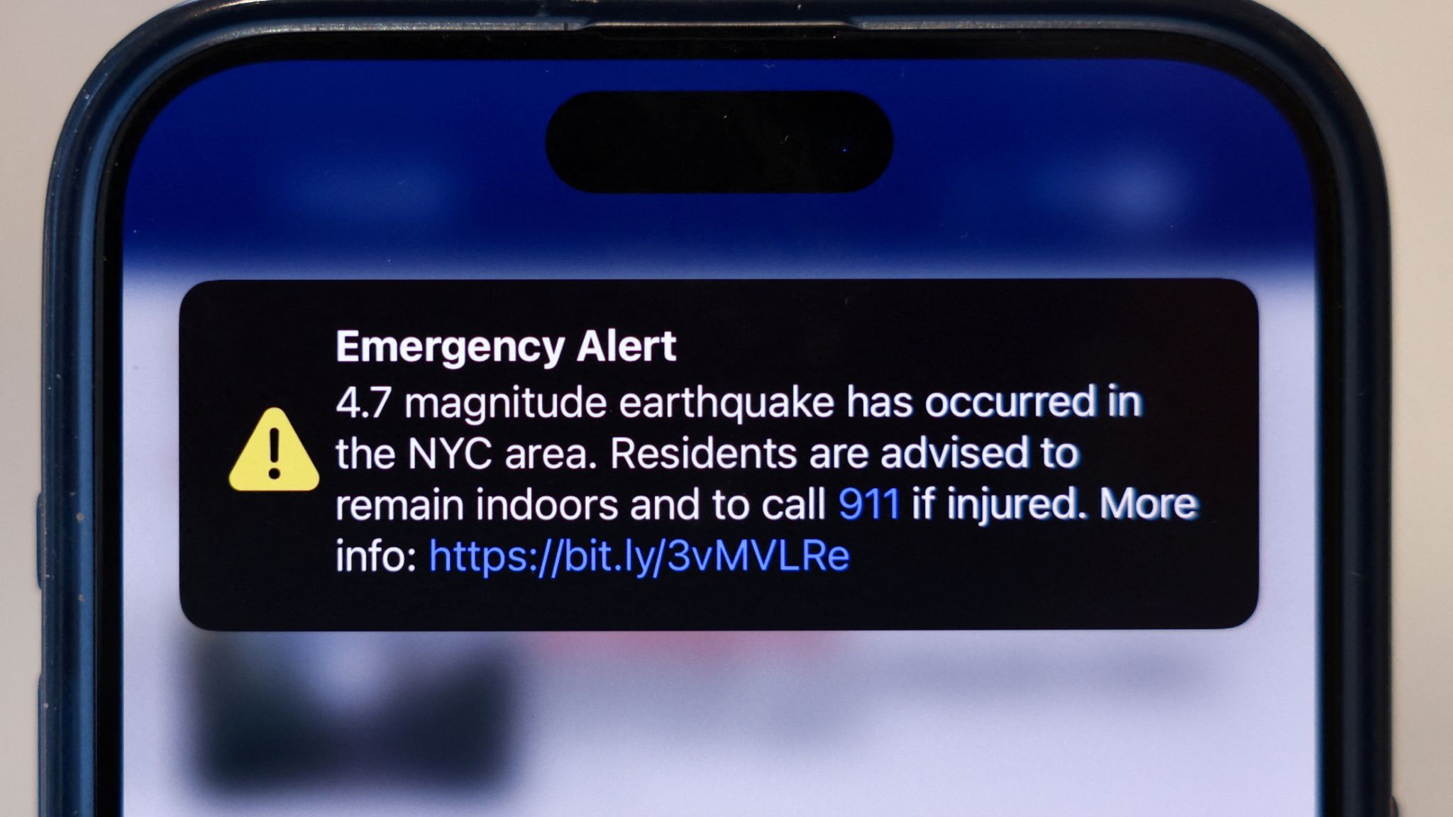
- Emergency Alerts: The city’s Notify NYC system, along with FEMA’s Integrated Public Alert and Warning System (IPAWS), is capable of delivering real-time alerts via text, email, and app notifications.
Interagency Coordination and Response Planning
- Citywide Response Framework: NYCEM maintains an Earthquake Annex within its Comprehensive Emergency Management Plan (CEMP). This annex outlines roles for agencies including NYPD, FDNY, the Department of Buildings, and the Department of Transportation.
- FEMA’s Role: FEMA Region II, which oversees New York, has pre-positioned plans and mutual aid agreements in place. The agency also provides post-event recovery funding through programs like the Public Assistance Grant Program.
- Seismic Risk Assessments: NYC collaborates with the U.S. Geological Survey (USGS) and regional universities on seismic risk modeling to inform future planning and resource allocation.
Gaps and Challenges
Despite these efforts, experts continue to point out several areas for improvement:
- Low Public Awareness: A 2023 survey by Columbia University found that fewer than 20% of NYC residents knew what to do during an earthquake.
- Retrofitting Cost Barriers: Private building owners often find seismic upgrades prohibitively expensive, especially for unreinforced masonry buildings.
- Outdated Infrastructure: Much of the city’s aging transit and water infrastructure was not designed with seismic safety in mind.
Still, officials emphasize that even rare events like the August 2, 2025 quake underscore the need for continual investment in resilience. As climate and geological volatility increase globally, urban centers not traditionally known for earthquakes must remain vigilant.
Implications for Infrastructure & Policy
Building Code Considerations
- Most NYC buildings built before 1995 follow no seismic design code.
- Structural experts advise retrofitting unreinforced masonry and securing building facades for lateral shaking resilience.
Emergency Management Protocols
- NYC Emergency Management confirmed swift assessment: no reported damage or injuries, emergency services remained on standby.
- However, media coverage of the April 2024 quake noted delays in Wireless Emergency Alerts reaching residents, indicating scope for improvement in alert systems.
Conclusion & Strategic Recommendations
- Magnitude 3.0 quakes pose minimal hazard, but this one served as a timely reminder of seismic potential in the Northeast.
- Continuous monitoring by USGS, routine updates to emergency alert systems, and reinforcement of older structures support urban resilience.
- Residents benefit from practical preparedness: secure fixtures, know safe actions during a tremor, and stay informed via trusted geological and emergency channels.
- Urban planners and policymakers should treat rare tremors as opportunities to reinforce building codes, retrofit older structures, and refine emergency protocols.


Hope everyone is alright
[…] Magnitude 3.0 Earthquake Shakes NYC: What You Need to Know […]